Restorative Alley Pathway Projects
Long Beach, CA
Holistic placemaking that cultivates community empowerment and stewardship where creative design, safety, open space, public art, and culture intersect.
The Restorative Alley Pathway Projects is an equitable neighborhood initiative with the intent to use and repurpose alleys to address park equity, public safety, neighborhood connectivity (both spatial and social) and community well-being through creative design and programming. A major objective of this initiative is to ensure that the voice of the community is heard (in a collaborative fashion) in all facets in of the visioning and design process. To heavily advocate for the community to take up space in the decision-making process and transform their built environment is a strong emphasis.
The Restorative Alley Pathway Projects is an equitable neighborhood initiative with the intent to use and repurpose alleys to address park equity, public safety, neighborhood connectivity (both spatial and social) and community well-being through creative design and programming. A major objective of this initiative is to ensure that the voice of the community is heard (in a collaborative fashion) in all facets in of the visioning and design process. To heavily advocate for the community to take up space in the decision-making process and transform their built environment is a strong emphasis.
Alleybrije Pathway Project
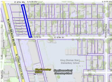
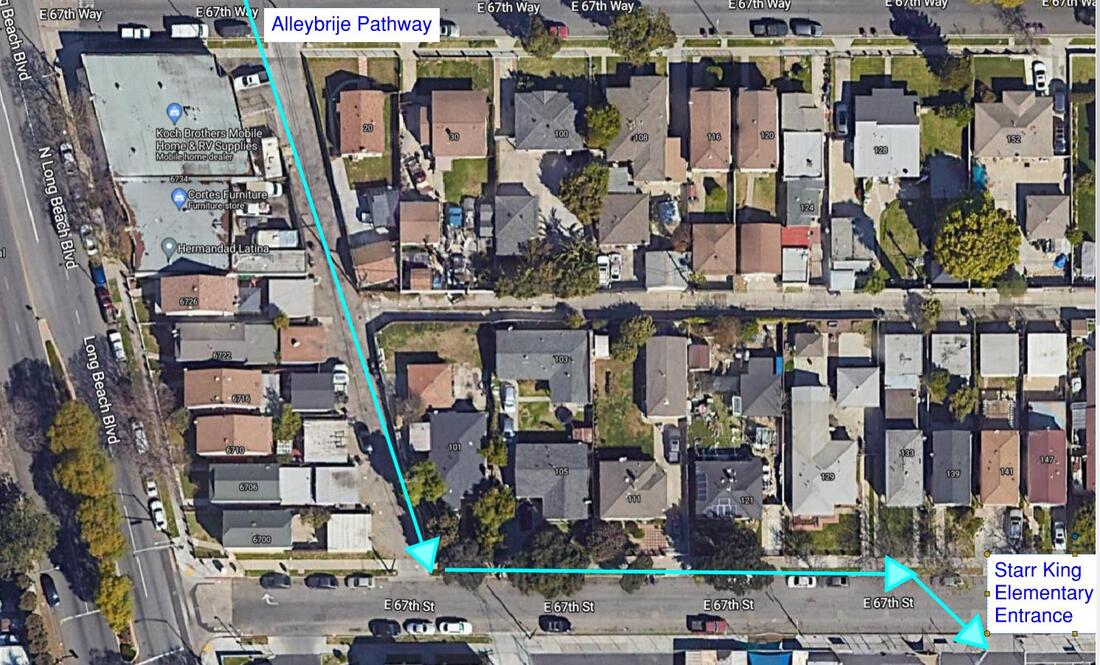
The proposed Alleybrije Pathway Project involves one segment of the neighborhood alley network in North Long Beach currently used by the community to get around, gather and connect. The location identified is between: Long Beach Blvd and Muriel Ave, West to East; and 67th Way and 67th Street, North to South (see maps below). The area is approximately 280 linear feet and 20 feet wide of existing concrete. Abutting Starr King Elementary School at its southern end, students and families walk daily through the alley on their way to and from school. The current condition of the pathway imposes a safety risk to pedestrians because of the shared space with cars and trucks. There is also the element of ongoing crime activity and trash dumping that is chronic. The intent is to transform this alley space and prioritize the creation of usable open space, pedestrian safety, reduce crime activity, and provide opportunities for community building.
Dime Alley Project
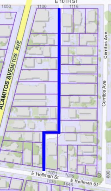
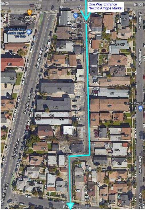
The proposed pathway is a one-way entrance alley. The location identified is between: Alamitos Ave and Cerritos Ave, West to East; and 10th Street and Hellman Street, North to South. (see maps below). The area is approximately 730 linear feet and 19 feet wide of existing concrete. Positioned next to Amigos Market, children and families commute through the alley on their way to the store. The alley is nearby Franklin Middle School so students often walk through on their way to and from school. It’s important to mention many residents access their homes through the alley as well. The current lack of lighting of the pathway imposes a safety risk to pedestrians, especially for women and children. The intent is to transform the alley space with community lead programming and design focused on safety, art, and green infrastructure. To prioritize pedestrian well-being and opportunities for community building. There is also the element of ongoing crime activity and trash dumping that is chronic. The intent is to transform this alley space and prioritize the creation of usable open space, pedestrian safety, reduce crime activity, and provide opportunities for community building.


